THURSDAY, AUGUST 30, 2012
This guest post is by Dr. Steffen Fritz, and Ian McCallum, researchers for the International Institute for Applied Systems Analysis, an international research organization that conducts policy-oriented research on global problems.
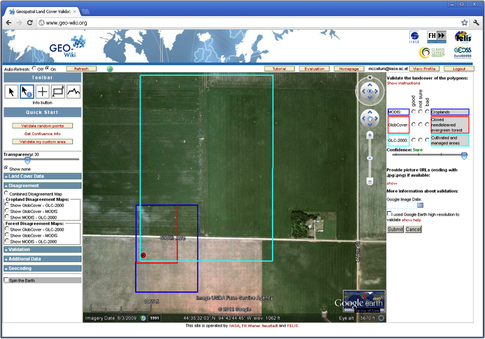
During the last decade, scientists have created several global land cover datasets. Comparison studies show that there are large spatial discrepancies between these products. One reason for these discrepancies is the lack of sufficient ground data for developing and validating these products. To address this issue, we have created the crowdsourcing tool Geo-Wiki.org, a web application using the Google Earth API and Google Earth plug-in. We chose Google Earth largely because of Google Earth’s navigation functionalities, including the ability to adjust the globe’s tilt and see the structure of the Earth’s surface, a significant advantage in recognizing land cover.
No comments:
Post a Comment