Friday, September 30, 2011

Google Earth Layers - Soil Survey CA, USA


Streaming Soil Survey Data in Google Earth (updates)http://www.blogger.com/post-create.g?blogID=1235176152203720336

Submitted by dylan on Thu, 2008-04-17 00:55.
STATSGO KML sample imageSTATSGO KML thumbnail
SSURGO KML ThumbnailSSURGO KML Thumbnail
A short update to a previous post on the visualization of NCSS/USDA soil survey data in Google Earth. The use of the NetworkLink construct, combined with the spatial indexing present in PostGIS, allows for very rapid lookup and presentation of this massive database. Scale-dependant switching between the detailed (SSURGO) and generalized (STATSGO) databases is done through simple area calculation in PostGIS.
Here is the link to the KMZ file. Here is a link to our conventional viewer application, based on Ka-Map / Mapserver, using the same PostGIS back-end (previous post on this). This PLSS KML file is very useful along-side soil survey information.

Feedback is always welcome!

Updates:
  • added link to download-able KMZ file, no longer need to manually create a network link
  • KMZ (compressed KML) is now used to for streaming soil survey data (5x-10x smaller files)
  • graphical component summaries are presented in the map unit info "bubble"
Soil-Web Graphical Component ListSoil-Web Graphical Component List

Google Earth Maps - PLSS


Township and Range - Public Land Survey System on Google Earth.

A user account is recommended for the features on this web page.  

Click for larger image.
http://www.earthpoint.us/townships.aspx

This page maps the United States Public Land Survey System onto Google Earth.  For more information about the land survey, Wikipedia has a good article.  You can read about locating parcels at Earth Point Blog.

There are two data sets to choose from, "BLM" and "National Atlas".

BLM Township, Range, and Section

Displays townships, sections, and quarter-quarter sections if you zoom in close enough (most, but not all areas have quarter-quarter sections mapped).  Calculates area, centroid, and corner points.  You must zoom into the central or western United States to see the data.

Help: How to install township and range.


>> This is a great example of a small page with great utility. MM <<

Thursday, September 29, 2011

LightRoom 3.5 + Heaps of New Cameras


Adobe posts final Lightroom 3.5, Camera Raw 6.5 releases

updated 09:25 am EDT, Thu September 29, 2011


Adobe has posted the final editions of the Lightroom 3.5 and Camera Raw 6.5 updates. In both circumstances the software adds support for over 20 cameras. Consumer-level additions include the Fuji FinePix F600EXR, Nikon Coolpix P7100, Pentax Q, and Ricoh GXR Mount A12, as well as Olympus' E-P3, E-PL3 and E-PM1, Panasonic's DMC-FZ150, DMC-G3 and DMC-GF3, and Sony's NEX-C3, NEX-5N, SLT-A35, SLT-A65 and SLT-A77.
Among several added medium format cameras and backs are the Hasselblad H4D-60, Leaf's Aptus II 12 and 12R, and Phase One's IQ140, IQ160, IQ180, P40+ and P65+. The updates moreover introduce another 25 lens profiles, covering models such as the Nikon AF-S Nikkor 35mm f/1.4G ED and the Canon EF 14mm f/2.8L USM. Using the profiles can fix endemic lens issues, such as distortion or chromatic aberration.

A variety of bugs reported in release candidates should now be fixed. The final updates are free downloads for existing Lightroom 3 or Photoshop CS5 users. Matching versions are available for Mac and Windows systems.


Read more: http://www.electronista.com/articles/11/09/29/adds.support.for.over.20.more.cameras/#ixzz1ZMHoA2rl

Wednesday, September 28, 2011

Deep Diving


SeaLife underwater camera features big buttons

When SeaLife Cameras says “create your own personal undersea concerto of sight and sound,” the company is not just waxing poetic: its new underwater camera has five piano-style keys for easier use in the seas.

The “new design redefines simplicity,” the company says. The five large primary control keys eliminate the confusing button cluster of a traditional camera, “to provide simple one-handed operation in any environment—even with gloves on.”

The DC1400 is a 14-megapixel camera that also captures 720p HD video, and has a 3-inch LCD and 5X optical zoom lens.

The $530 camera is depth-tested to 200 feet, according to SeaLife, and the external polycarbonate body is rubber-armored “for sure-grip handling and shock-protection in all conditions.” The pocket-sized inner camera can be removed from the waterproof housing.

The six underwater Modes include Dive, with UW color correction for diving without external flash, and Snorkel, with UW color correction for snorkeling without external flash.

How bad can it get?

  • Accidental deletion of photos
  • Deletion during transfer from one device to another
  • Deletion due to memory card corruption
  • Accidentally deleting photos from the digital camera by pressing the Delete All button while previewing the photos
  • Photos deleted or lost when a memory card is pulled out abruptly from the card reader/camera during copy process
  • Photos getting deleted by third party tools on basis of the filename
  • Erasing all photos accidentally using format card option from the camera
  • Switching off the camera during transfer of photos
  • Capturing photos when the camera is low on battery
Oh No, Oh No, I better get cracking... 

Tuesday, September 27, 2011

GPS Cams Get Reviewed...

Top Seven Cameras With GPS - Including Video Cameras

New Generation of Digital Cameras Let You Geotag Photos and More

By , About.com Guide

When camera makers first started building GPS chips into their cameras, they weren't quite sure what to do with them. The on-board firmware was minimal and could be challenging to use. But now manufacturers have figured out this niche, offering cameras that are ruggedized and waterproof, or that mount on a bike or ski helmet, or that provide full-featured GPS functions, in addition to still and video image capture. Check out the review for the latest and greatest in camera GPS. Click on photos to enlarge view.

Nikon COOLPIX AW100 ($370 - $390)
Nikon


The Nikon COOLPIX AW100 is one of a new generation of GPS-enabled digital cameras that is waterproof, and shock and freeze-resistant. You can take this camera as deep as 33 feet in water, and it will continue to shoot at temperatures as low as 14 degrees F. Nikon promotes the camera for use outdoor sports ranging from skiing to kayaking to mountain biking. I do appreciate having a waterproof camera on board on a river trip. Other features:
  • Built-in map display and electronic compass.
  • 16-megapixel.
  • 1080p HD movie mode.
  • Glove-friendly controls.
  • Motion-detecting focus tracking.
  • 5x optical zoom, NIKKOR ED glass lens.
  • HDMI output.
  • In-camera image editing.

Pentax Optio WG-1 GPS ($349 - $399)

Pentax Optio WG-1 GPS cameraPentax
Like the Nikon AW100, the Pentax Optio WG-1 GPS represents the latest generation of GPS-enabled "adventure" cameras that are ruggedized and waterproof. Make sure you are getting the "GPS" version if you are shopping for this camera because there are similar non-GPS models. The Pentax Optio WG-1 GPS has ergonomic, glove-friendly controls. Other features:
  • Waterproof to 33 feet.
  • Functions down to 14 degrees F.
  • 14-megapixel sensor.
  • 5X internal optical zoom.
  • 720p HD video.
  • HDMI output.
  • Low-light autofocus assist lamp.

ContourGPS Wearable Camcorder ($265 - $299)

ContourGPS video cameraContour
The ContourGPS video camera from Contour gets into the thick of the action. This ruggedized and water-resistant camera is designed to mount on a helmet or via any of a nice range of mounts (handlebar, etc.) offered by Contour. The ContourGPS shoots in HD 1080p and has a large, 135-degree wide-angle lens. It also has a built-in mic. The ContourGPS records on an internal microSD card, expandable up to 32GB. Other features:
  • Includes free custom software (Mac or PC) for upload and editing.
  • Auto-maps speed, location, and elevation up to 4X per second.
  • Replay route on Google Maps.

Panasonic Lumix DMC-ZS10 ($257 - $264)

Panasonic Lumix DMC-ZS10 with GPSPanasonic
Panasonic's Lumix GPS displays latitude and longitude, but it also includes regional and landmark information for more than 1 million locations in 82 countries. The Lumix DMC-ZS10 is also known for its large (3-inch diagonal) high-resolution LCD rear display, which provides terrific image previews. Addittional features:
  • 14.1 megapixel.
  • 16x optical zoom with wide angle.
  • Full 1080 HD video recording.
  • 3D image mode. 


Sony HDR-CX700V Digital Video Camera With GPS ($959 - $1,200)

Sony HDR-CX700V digital video cameraSony
The HDR-CX700V is a high-performance video camera with a built-in GPS chip that geotags video and still images (the geotag feature may also be switched off). The camera also comes with built-in NAVTEQ maps and will display your current location. Geotagged images and videos may be reviewed and played back using the camera's map index function. The GPS signal also automatically sets the camera to the time zone in which it is located. Other features:
  • SteadyShot image stabilization.
  • Golf Shot: High-frame rate, slow-motion video capture.
  • Built-in flash.
  • 14X extended zoom.
  • Built-in 96GB flash memory (up to 40 hours of video).
  • 12MP still images.

Fuji FinePix F550EXR ($280 - $319)

Fuji FinePix F550EXR camera with GPSFuji
The Fuji FinePix F550EXR with GPS displays latitude and longitude, and location name as you shoot. This information is stored with each still or video image. GPS may also be used for in-camera image search, and to create separate photo-book folders. You may also view images by location, or create an image track travelogue map using Fuji's included FinePix Studio computer software. Other features:
  • 16-megapixel.
  • 15X optical zoom.
  • 3-inch, hi-res LCD monitor.
  • Image stabilization.
  • HD movie mode.
  • Intelligent flash.
  • Face detection.

Garmin Montana 650t ($629 - $670)

Garmin Montana 650t reviewGarmin
The Garmin Montana 650t is actually a GPS with a camera, rather than a camera with GPS. It's a full-on, ruggedized and waterproof GPS navigator that can provide turn-by-turn directions on the highway, and then provide you with high-end backcountry navigation features and detailed topo maps. I used the Montana 650t on a western trip and posted my review here. With a 5-megapixel camera, small lens, and modest camera features, the Montana 650t does not compete with this group on image quality, but it is a strong option for those who want to integrate multiple devices in a tough and reliable GPS navigator. The Montana has dual-battery capability: Rechargeable li-ion, plus AAs.

Friday, September 23, 2011

Next Step for Media - Mining and Abstraction


What is ImagePlot?

ImagePlot is a free software tool that visualizes collections of images and video of any size. It is implemented as a macro which works with the open source image processing program ImageJ.

ImagePlot was developed by the Software Studies Initiative with support from the National Endowment for Humanities (NEH), the California Institute for Telecommunications and Information Technology (Calit2), and the Center for Research in Computing and the Arts (CRCA).


See your whole image collection in a single visualization.

Existing visualization tools show data as points, lines, and bars. ImagePlot's visualizations shows the actual images in your collection. The images can be scaled to any size and organized in any order - according to their dates, content, visual characteristics, etc. Because digital video is just a set of individual still images, you can also use ImagePlot to explore patterns in films, animations, video games, and any other moving image data.

Better understand media collections and make new discoveries.

Visualize image collections as timelines and scatter plots which display all images in a collection. Find images that are outliers. Discover clusters - sets of images that are similar in content or visual properties. Visualize multiple sets of images to better understand their similarities and differences. Explore patterns in existing metadata (i.e., dates, names, etc.), added annotations and keywords, or visual features (i.e., brightness, saturation, hue, shapes, etc.)

Visualize change

We include macros which automatically measure various visual properties of every image in collection (or every frame in a video). These measurements can be visualized as line graphs, scatter plots, and image plots. This allows you to see the patterns of change over time in images' visual characteristics. You can also compare multiple image sets in terms of their visual characteristics.

Visualize image collections of any size.

From a few dozens to millions of images. There is no theoretical limit to the number of images that can be included in a single visualization. A few dozen images can be visualized in a second, a few thousands will take a few minutes. The largest number we tried so far was one million images ( yes, this took a while - but it worked!). If your collection is really big, start the render and just come back when it is finished.

How does it work?

From points to images.

Start with point and line graphs, which allow you to quickly explore your image set. Once you find an interesting pattern, re-render the plot to show the images. Go back and forth between these options as often as you like.

Render and save high-res visualizations.

You can render and save greyscale and full-color visualizations of any size (as long as they don't go over 2.5 GB.) For example, we created 44,000 x 44,000 grey scale visualization showing one million manga pages, 137,530 x 13,800 visualization showing all shots in an hour long film, full-color 16,000 x 12,000 visualization showing 776 van Gogh paintings. (All were rendered on Mac Book Pro with 4GB of RAM).

Turn any visualization into an animation.

Select the option to save visualization after each new image is added to it. The result is a sequence of files which can be easily turned into video (use QuickTime or any video editing application).

Customize everything.

Customize the appearance of data points and lines, background, axis lines, data labels, image labels, the size of images, image transparency, and pretty much everything else you can think of. We wrote ImagePlot to support both quick exploration of image sets and creation of high-res visualizations for publications and exhibitions. So we added options to control every possible aspect of visualization appearance. Visualizations created with ImagePlot have been shown in science centers, art and design museums, and art galleries, including Graphic Design Museum (Breda), Gwangju Design Biennale (Korea), and The San Diego Museum of Contemporary Art.

Use with digital image analysis tools.

Measure various visual properties of the images in a collection (brightness, saturation, hues, shapes) using macros we provide - or you can use any other digital image tools. Study patterns in these properties across a whole collection using ImagePlot visualizations.

Will it work with my stuff?

Work with images in all popular formats.

Color or grey scale images? JPEG or TIFF? No problem, ImagePlot can handle them all. If you images have different sizes, ImagePlot can also automatically scale them to the same size. If your images are located across multiple directories on your computer, we built in an option to handle this as well.

Cross-platform.

Run ImagePlot on Windows, Mac OS or Unix.

No coding required.

ImagePlot has a Graphical User Interface, so you don't need to program or script anything.

Use data created in other applications.

ImagePlot works with the most common data formats: a set of image files and the data about these images saved in a tab delimited text file (.txt). This makes ImagePlot compatible with lots of other applications for media cataloging, data analysis, and information visualization. You can prepare and edit data using any spreadsheet or word processor application. The data file can contain any number of rows and columns. (For example, our data file for one million manga pages had one million rows and 60 columns.)

Download and run ImagePlot in minutes.

ImagePlot is a macro which runs within the cross platform, open source image processing software ImageJ. Together these files take up under 5 MB. The full ~100MB download comes with several large sample data sets, which are helpful for getting started but not required for the software to run.

Download ImagePlot 0.9

Hardware requirements: 2 GB RAM (4GB or more recommended for high resolution visualizations with images).

Software Requirements: To use ImagePlot macro, you will first need to install the ImageJ application. ImageJ will run on Mac, Windows, or Linux. Application files for all three operating systems are included in the ImagePlot.zip download.

ImagePlot.zip 110 MB
ImagePlot macro, ImageJ application (Windows / Mac / Linux), sample data sets, theory and methodology articles.

ImagePlot-progam-only.zip 3 MB
ImagePlot macro, ImageJ application (Windows / Mac / Linux).

Something Old or New?


'What Was There' project adds a pinch of history to augmented reality

So, it works as such. You dig up ancient photos -- a few generations prior, or even a few decades ago -- scan 'em in, and tag them to their rightful place on Google Maps. Then, folks who visit the 'What Was Here' project website or download the iOS app (all linked below) will be able to see what kind of world they'd be living in if Uncle Rico's time machine actually worked. 'Course, the initiative needs you, you and you to participate if it's to be dubbed a success, so we'd recommend using whatever's left of your weekend to contribute. And then send your mum a "thinking of you" letter using the very map you're improving. Who said retro had to be retro, anyway?

Thursday, September 22, 2011

PowerShot S100 with GPS


Canon PowerShot S100 packs GPS


Canon last week added a new point shoot camera to its PowerShot range with PowerShot S100. The new Canon PowerShot S100 is a very compact camera with DSLR-like manual control and superb image quality low light. S100 is a successor to S90 and S95 and adds enhanced HS System, which combines a Canon high-sensitivity sensor with DIGIC 5.
Some other features include 24mm ultra-wide angle with 5.0x optical zoom lens, Image Stabilizer (IS), and more fun than any of this: the GPS functionality. With the newly added GPS feature you can record the time and location of every shot.
A few more of the key feature on PowerShot S100:
  • 12.1 Megapixel Canon CMOS (1/1.7 type)
  • HS System with powerful DIGIC 5
  • Ultra-wide 24mm, f/2.0, 5x zoom lens. Intelligent IS
  • Lens Control Ring, NR Control & RAW
  • GPS
  • Full HD, HDMI
  • Large 7.5 cm (3.0″) LCD
  • High-speed Burst HQ
  • Smart Auto, Multi-area WB

Tuesday, September 20, 2011

375 Billion Photos and the Count is Growning... no 3.5 Trillion


How many photos have ever been taken?

Today we take photos for granted. They are our memories of holidays and parties, of people and places. An explosion of cameras and places to share them (Facebook, twitter, instagram) means that our lives today are documented, not by an occasional oxidizing of silver halide but constantly recorded with GPS coordinates and time stamps. However it hasn't always been like this - the oldest photograph is less than 200 years old[1].

So how many "Kodak memories" has humanity recorded? How fast are we snapping photos today? And how many of these treasured memories are confined to our shoeboxes as lost relics of a pre-digital era?

First we quantify how many analog photos humans have taken. There is a surprising dearth of direct data, but we can make some reasonable estimates. It is safe to say that at most a few million photos were snapped before the invention of the first consumer camera - Kodak Brownie in 1901[2]. From that time we can use Kodak's employment statistics as a reasonable proxy for how many photos were taken (Kodak’s dominance of those "Kodak moments" persisted for most of the 20th century). More physical photos needed more physical cameras and rolls of print[3]. Throughout this period photos became more and more mass-market - by 1960 it is estimated that 55% of photos were of babies. From 1984 onwards the Silver Institute and PMIA published estimates of how many physical photos the world was snapping each year (silver halide being an important chemical in film)[4]. Year after year these numbers grew, as more people took more photos - the 20th century was the golden age of analog photography peaking at an amazing 85 billion physical photos in 2000 -- an incredible 2,500 photos per second.

At the dawn of the new millennium a new technology (that Kodak itself invented) was reshaping the whole industry - the digital photo. When the first few hundred thousand digital cameras shipped in 1997 their memory was strictly limited (in fact cameras like the Sony Mavica took floppy disks[5]!). Digital cameras are now ubiquitous - it is estimated that 2.5 billion people in the world today have a digital camera[6]. If the average person snaps 150 photos this year that would be a staggering 375 billion photos. That might sound implausible but this year people will upload over 70 billion photos to Facebook, suggesting around 20% of all photos this year will end up there[7]. Already Facebook’s photo collection has a staggering 140 billion photos, that’s over 10,000 times larger than the Library of Congress.[8]


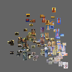
Even accounting for population growth the exponential growth of photos is incredible (we take 4 times as many photos as 10 year ago). Today every party, birthday, sports game and concert is documented in rich detail. The combination of all these photos is a rich portrait of today, the possibilities of which are illustrated by a tool like “The Moment”. As photos keep growing we take a clearer and clearer snapshot of our lives and world today - in total we have now taken over 3.5 trillion photos. The kind of photos we are taking has changed drastically - analog photos have almost disappeared - but the growth of photos continues.
.

In the midst of the 3.5 trillion photos that have ever been taken it's easy to forget that the shoebox or album of old photos we have at home is incredibly fragile and special. Every 2 minutes today we snap as many photos as the whole of humanity took in the 1800s. In fact, ten percent of all the photos we have were taken in the past 12 months. And yet, there are still more physical photos hidden in our shoeboxes, hanging on our walls or lost in an album than there are digital photos littering our hard drive. These precious photos of the past 200 years tell us who we are and where we come from. So grab hold of that photo of you as a kid or of your grandparents' wedding and realize just how special it is.

Footnotes
1. The oldest photo of a person dates to 1838; an image of a busy Parisian street that shows an unknown man getting his shoes shined
2. Check out see some amazing 19th century Civil War photos online here.
3. In an industry focused on consumer facing innovation labor productivity is assumed to be roughly constant. An anchoring reference of 2.2 billion photos in the US is also used fromhere. Reporting on Kodak’s empolyee numbers is available here.
4. PMIA numbers are used from 1984 to 1998 5. The Sony Mavica was one of the earliest consumer digital cameras
6. Tomi Ahonen reports there there are 2.5 billion cameraphones. Almost all people who own dedicated digital cameras also own a phone with a camera.
7. Facebook reported the photo uploads were running at 6 billion per month here. Estimating the average number of photos taken is difficult given the broad user base - from photo fanatics snapping hundreds of photos per week on their SLRs to the vast mass of camera owners in developing nations with just a simple camera phone.
8. Instagram reported they have 150 million photos to TechCrunch here, Flickr's info on their 6 billion strong collection is here.

It just keeps getting better....


Intel: Ivy Bridge GPU to support 4K resolutions


Color us unsurprised that Ivy Bridge is destined to be faster and smaller than its predecessor, but unbeknownst to us is an interesting tidbit concerning the upcoming architecture's GPU. The revamp will support resolutions in excess of 4K (topping out at a maximum of 4,096 x 4,096) -- a sizable jump from the WQXGA (2,560 x 1,600) limitation of its Sandy Bridge's forebearer -- opening the door to all sorts of resolution independent goodness. Guess that means you won't need a discrete GPU in the future to power that bodacious (but pricey) pro-level display. Have a peek in the links below if you're hungry for more.